Sustainable Urban MObility Development in Outskirts
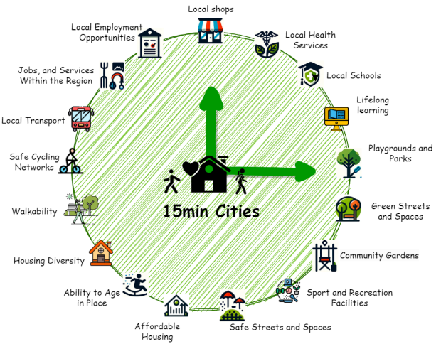
The SUMODO (Sustainable Urban MObility Development in Outskirts) project aims to facilitate the planning and acceptance of 15 minute cities by developing a software platform that will help urban planners to design and optimise the deployment of 15-minute cities as well as aid travellers’ decision.
Urban planners can encourage active transport modes by designing new green areas, pedestrian and cycling infrastructure. Yet, reducing the surface once reserved for private vehicles requires careful consideration of transport preferences to secure citizen’s acceptance of change in their neighbourhood. The SUMODO project will provide a simulation platform with tools to explore aspects such as the frequency and transport mode preferences of citizens and how to compute the accessibility to services. Using SUMODO’s simulations, urban planners will be able to optimise physical (e.g. pedestrianisation) and policy based (e.g. slow zones) interventions to foster the deployment of 15-min cities with minimum economic and social cost.
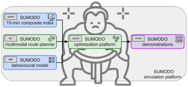
The primary objective of this project is to provide tools to help urban planners: to define and optimise 15-min city concepts in their neighborhoods. In particular, to provide tools based on EA to automatically identify neighborhoods in the outskirts where the density of POIs makes it possible to define a 15-min city. The tool will automatically determine the improvements in walkability, bikeability and accessibility to infrastructures to transform a not suitable outskirt into a 15-min city. To this end, the project will combine 4 components:

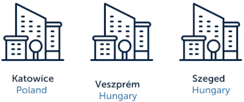
A pilot program will be implemented in a selected neighborhood within each city under study. These areas will undergo assessment and receive customized advice aimed at enhancing their 15-minute city composite index and modeling outcomes to fulfill the objectives of the 15-minute city concept.